Why This Route?
Taroko Gorge is Taiwan's most jaw-dropping natural wonder. The Liwu River spent millions of years carving through solid marble to create this canyon. Add Qingshui Cliff's Pacific coastline and the crescent pebble beach at Qixingtan, and you have the best of Hualien in one day. First visit or fifth, Taroko never gets old.
⚠️ After the April 2024 Hualien earthquake: Some trails in Taroko National Park are still closed due to earthquake damage. As of June 2026, the Swallow Grotto (Yanzikou) Trail, the Changchun Shrine Trail and the Zhuilu Old Trail are closed; the Shakadang Trail is only partly open; the Jiuqudong (Tunnel of Nine Turns) Trail is open by advance online reservation with capacity limits; and the Dekalun Trail is fully open. Conditions change, so always check the latest status on the Taroko National Park official website before you go. If a spot is closed, your itinerary can be rearranged around the places that are open.
Highlights
🏔️ Taroko Gorge & Swallow Grotto 燕子口, Walking Through a Living Marble Cathedral
Taroko's entrance arch is about 30 minutes' drive from Hualien city. As you head deeper into the gorge along the Central Cross-Island Highway (Route 8), the marble walls rise higher and closer on both sides — like stepping into a geology textbook, only far more dramatic.

The most famous stretch is Swallow Grotto (Yanzikou), where the cliffs are pitted with potholes carved by the river over millions of years, and swallows dart in and out in spring and summer. The Yanzikou trail is currently closed for repairs because of rockfall risk. To walk through the gorge, we recommend the Jiuqudong (Tunnel of Nine Turns) Trail, open by advance reservation — the canyon walls close in overhead while the jade-green Liwu River rushes below. No photo quite captures that feeling.
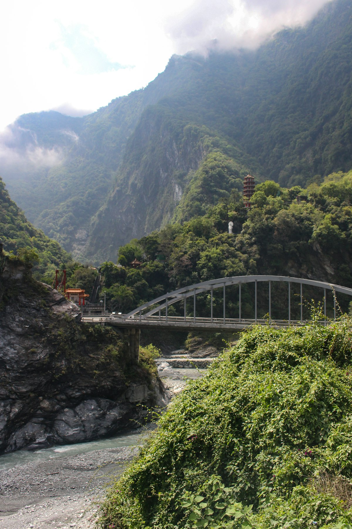
Near the visitor center, the fully open Dekalun Trail climbs forest steps to viewpoints over the Liwu River mouth and Taroko's mountains.
Photo tips: Around 9–10 AM, sunlight reaches into the gorge and the river turns its brightest jade green. In the narrowest sections, shoot upward with a wide-angle lens for a "sliver of sky" shot. Never linger in rockfall zones — wear a helmet where required and follow on-site signs.
🌊 Qingshui Cliff 清水斷崖, The Most Stunning Coastline on the Pacific

About 40 minutes north of Taroko, the Suhua Highway reaches Qingshui Cliff. The rock face drops over 800 meters almost straight down into the Pacific. When you step out at the lookout, the first thing you do is say "wow." You cannot help it.
The water below shifts through layers of color. Near shore it is pale turquoise. Further out, it turns sapphire blue, then deep indigo. On a clear day the gradient looks unreal, like someone turned the saturation up too high. But it is not edited. It is just that beautiful.
Photo Tips: Chongde Lookout is the classic spot. Morning light brings out the best water colors. For a wider view, ask your driver to stop at Huide Rest Area, which overlooks the full cliff arc from above. Save this one for a sunny day. On cloudy days, fog hides the color layers.
🏞️ Shakadang Trail 砂卡礑步道, Turquoise Water Over White Marble
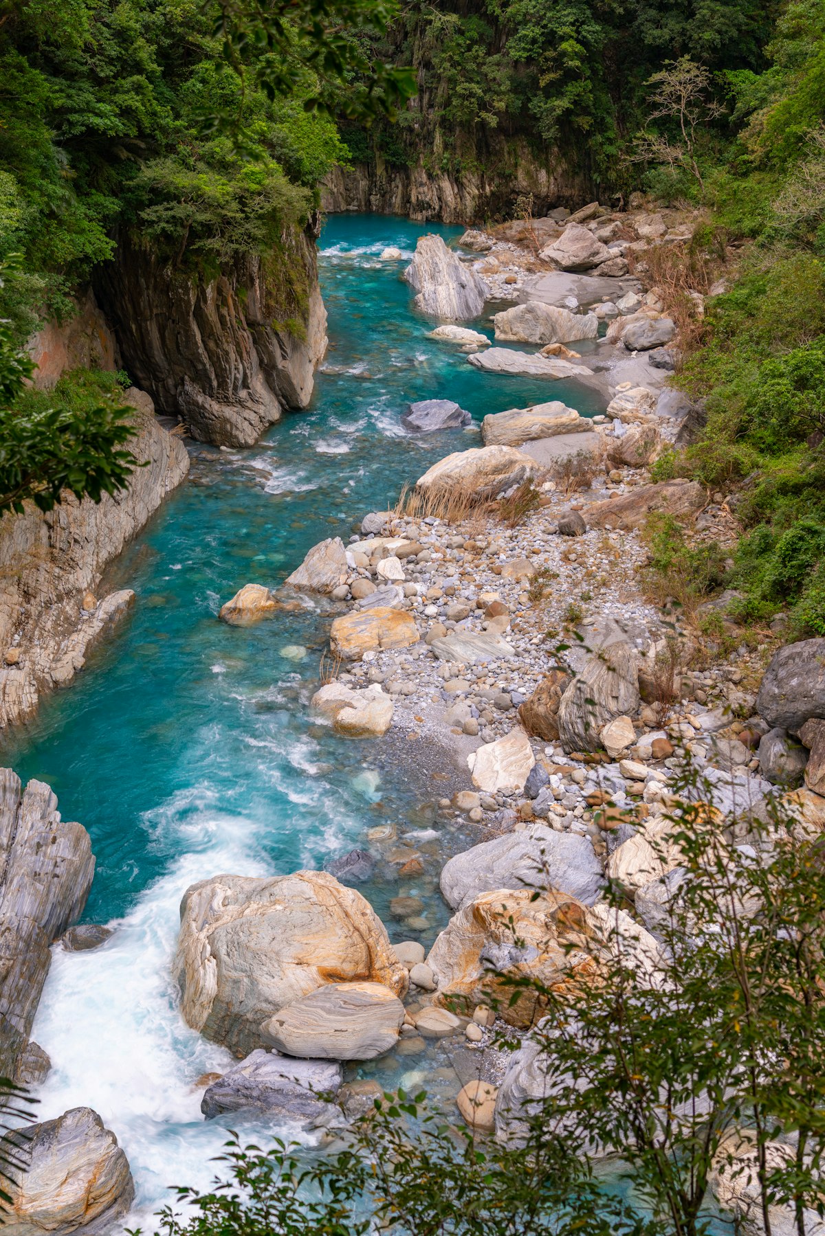
The Shakadang Trail starts right beside the Taroko Visitor Center. Carved into the canyon wall along Shakadang Creek, it follows water so clear you can see the marble patterns on the riverbed — that jade color is natural, not a filter. The trail was badly damaged in the earthquake and, as of June 2026, only part of it is open, so check which section is accessible on the official website before you go.
Photo tips: Look down from the red Shakadang Bridge at the entrance for the clearest view of the water's color — it's most vivid around midday when the sun is directly overhead.
🏛️ Changchun Shrine 長春祠, Eternal Spring Above the Gorge

Changchun Shrine is Taroko's most iconic landmark: a Chinese-style shrine perched on a cliff beside a waterfall that flows all year round. It honors the workers who died building the Central Cross-Island Highway — the road through the Central Mountain Range was dug almost entirely by hand, and more than 200 lives are said to have been lost.
The trail and suspension bridge up to the shrine are currently closed due to earthquake damage, but the roadside viewpoint still gives you the classic postcard view of shrine, waterfall and gorge in one frame.
Photo tips: The viewpoint is a few minutes' walk from roadside parking. The light is most even around 2–3 PM, so neither the waterfall nor the shrine is backlit, and the falls are at their fullest after rain.
🏖️ Qixingtan Beach 七星潭, Pacific Sunrise on a Crescent of Stones
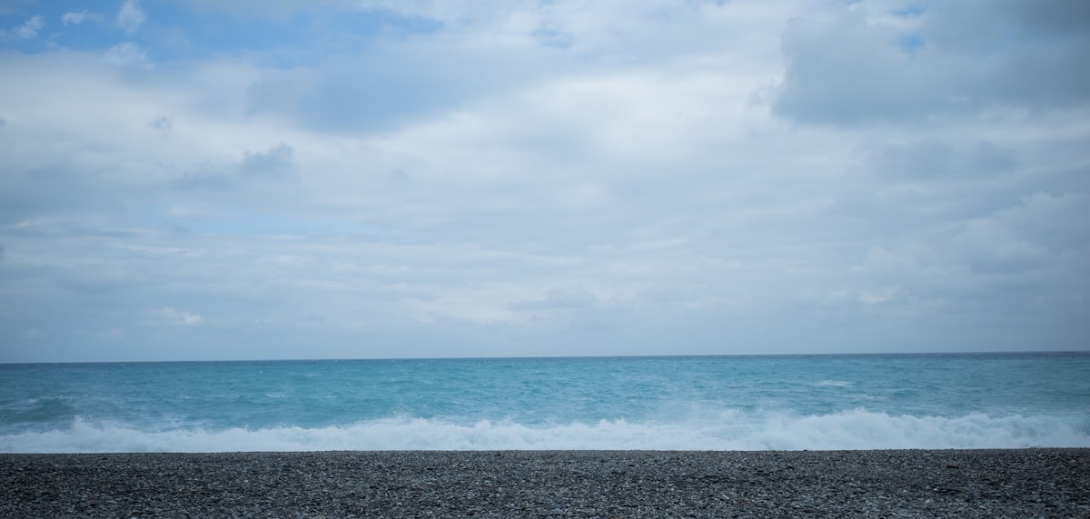
The name means "Seven Star Pond," but Qixingtan is actually a long crescent beach. Instead of sand, it is covered in smooth round pebbles shaped by centuries of waves. Walk on the stones, listen to the waves click against them, and watch the Pacific stretch to the horizon. This is where Hualien locals come after work to clear their heads. No agenda needed.
What makes this beach special is the backdrop. The Central Mountain Range rises right behind it. On a clear day you get mountains and ocean in one frame. At sunset, the water turns gold and the mountains become dark outlines against the sky. It is the most calming view in Hualien.
Must-Eat (Back in Hualien City):
- Gongzheng Baozi 公正包子 — Hualien's most famous steamed buns. Thin skin, juicy filling, and a line from 5 AM
- Ye Xiang Wontons 液香扁食 — Over 60 years old. Delicate pork wontons in clear broth. A Hualien breakfast staple
- Dai Ji Wontons 戴記扁食 — The rival to Ye Xiang, with even thinner wrappers
- Bomb Scallion Pancake 炸彈蔥油餅 — A street-side legend. Flaky pancake with a runny egg that bursts when you bite in
- Temple Mouth Black Tea 廟口紅茶 — Old-school black tea poured through vintage steel pipes. Only in Hualien
Suggested Itinerary
This plan is built around the places open as of June 2026; stops are swapped depending on conditions on the day.
Morning — Into the Gorge
- 08:00 Depart Hualien city (about 30 min to Taroko)
- 08:30 Taroko Visitor Center — pick up a map and check today's trail status (~20 min)
- 08:50 Dekalun Trail, or the open section of the Shakadang Trail (~1 hr)
- 10:00 Changchun Shrine viewpoint (~20 min)
- 10:30 Jiuqudong Trail (advance reservation required, ~1 hr)
Afternoon — Coastal Grandeur
- 12:00 Lunch near the Taroko entrance
- 13:00 Drive to Qingshui Cliff (~40 min)
- 13:40 Qingshui Cliff viewpoints (~40 min)
- 14:30 Head back toward Hualien for Qixingtan Beach (~40 min)
- 15:10 Stroll Qixingtan Beach (~1.5 hrs)
Evening — Hualien Food Crawl
- 17:00 Back in Hualien city — Gongzheng Baozi, Yixiang Wonton and the famous "bomb" scallion pancake
- 18:00 Drop-off at your hotel
Practical Tips
- Best season: October to April brings stable weather and less rain. Summer (June–September) is typhoon season, and trails often close after rockfalls
- Check what's open: Closures and traffic restrictions are still in place after the earthquake. Check the national park's official website before you go, and book the Jiuqudong Trail online in advance
- Beat the crowds: Weekdays are far quieter. On weekends, enter Taroko before 8 AM, ahead of the tour buses
- What to wear: Sneakers or hiking shoes are a must — some sections are slippery. In summer bring sun protection and plenty of water; the gorge gets hotter than you'd expect
- Safety: In rockfall areas, follow on-site instructions, wear a helmet where required, and never enter closed sections
- Talk to your driver: Chat with your driver in the RelayGo app is translated automatically — just ask in English where to go instead of a closed spot
More Routes to Explore
- Yilan Day Trip — Hot springs, traditional arts, and night market — 1 hour from Taipei
- Sun Moon Lake Day Trip — Central Taiwan's most stunning lake scenery
- Jiufen & Shifen Day Trip — Also passes through Ruifang — add Pingxi Line sky lanterns
🚌 Can You Get There by Public Transit?
Taking the train to Hualien is easy (~2-2.5 hours from Taipei, NT$440), but getting into Taroko Gorge is the challenge — there is no regular bus service inside the gorge. Independent travelers have two options:
Option 1: Taiwan Tourist Shuttle — Taroko Line (1133A/1133B)
- Departs from Hualien Station, stops at Taroko Visitor Center, Shakadang Trail, Swallow Grotto, Tianxiang
- Very few runs per day (only 3-4), and you'll need to stay overnight in Hualien to catch the morning bus
- Extra runs on weekends, but check in advance
- Many Hualien travel agencies offer Taroko shared day tours (~NT$800-1200/person)
- Includes pickup + guide, no transport hassle — but fixed itinerary, no customization
💡 After the earthquake, some Taroko bus routes and stops may have changed. Check the latest schedules on the official websites before you travel.